
Geography / 10 questions
US states map quiz
One highlighted state. Can you name it?
About 3–5 minutes · No timer

10 random questions per round · 50 questions in the full bank below
Published by Quizpen · Explanations include linked supporting reading. See our source-checking process and review limits.
Getting your round ready…
BEHIND THE ROUND
A little more about this quiz
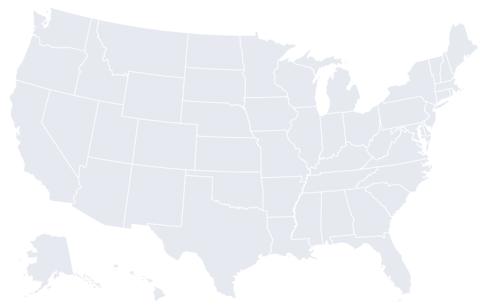
The national map gives you the location; the enlarged outline helps with the shape. Every state has its own question, including Alaska and Hawaii in separate insets. Type a state name or its postal abbreviation, or switch to four answer choices when you need a clue.
This is an identification quiz rather than a speed test. There is no timer and no penalty for taking a closer look. A retry chooses a fresh set from the fifty-state bank. The printed sheet keeps the maps with the questions, so it also works for a classroom or geography night.
QUESTIONS & ANSWERS
US states map quiz: the full question sheet
Take a free US states map quiz: name each highlighted state by its outline and position. Play 10 of 50 questions with enlarged views and an answer key.
By Quizpen · Updated
Browse the full question bank50 questions & answers
Name the state highlighted on map 01.
 THE HIGHLIGHTED STATE
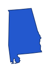
Alaska and Hawaii appear in insets; all states use modern boundaries. Reveal answer
Alabama. The highlighted state is Alabama (AL). Alabama lies between Mississippi and Georgia, below Tennessee. Its short southern coastline helps distinguish it from neighboring inland Tennessee.
Sources for this answer
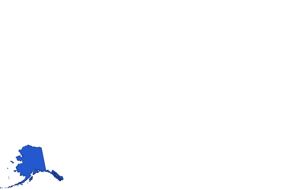
Name the state highlighted on map 02.
 THE HIGHLIGHTED STATE
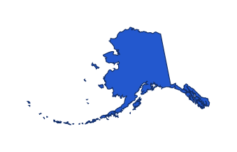
Alaska and Hawaii appear in insets; all states use modern boundaries. Reveal answer
Alaska. The highlighted state is Alaska (AK). Alaska is northwest of Canada, separate from the contiguous states. Its long southeast panhandle and island chain are distinctive even when it appears in a map inset.
Sources for this answer
Name the state highlighted on map 03.
 THE HIGHLIGHTED STATE
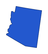
Alaska and Hawaii appear in insets; all states use modern boundaries. Reveal answer
Arizona. The highlighted state is Arizona (AZ). Arizona lies below Utah and west of New Mexico. Its mostly straight outline bends along the Colorado River boundary on the west.
Sources for this answer
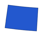
Name the state highlighted on map 04.
 THE HIGHLIGHTED STATE
Alaska and Hawaii appear in insets; all states use modern boundaries. Reveal answer
Colorado. The highlighted state is Colorado (CO). Colorado is the nearly rectangular state directly north of New Mexico. Wyoming has a similar shape but lies farther north.
Sources for this answer
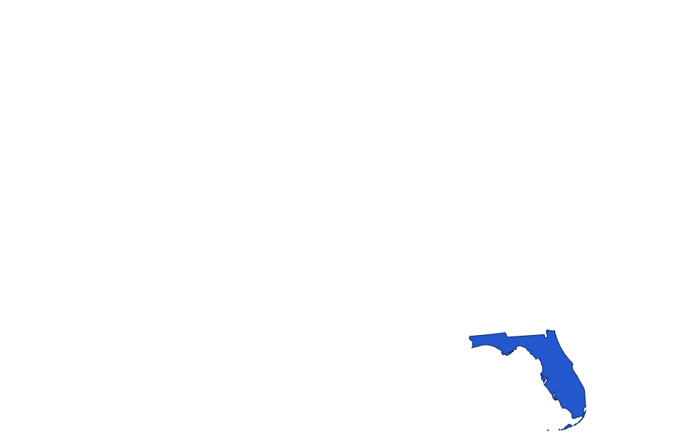
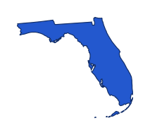
Name the state highlighted on map 05.
 THE HIGHLIGHTED STATE
Alaska and Hawaii appear in insets; all states use modern boundaries. Reveal answer
Florida. The highlighted state is Florida (FL). Florida’s long peninsula points south, while its panhandle extends west below Alabama. This combination is more distinctive than either part alone.
Sources for this answer
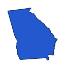
Name the state highlighted on map 06.
 THE HIGHLIGHTED STATE
Alaska and Hawaii appear in insets; all states use modern boundaries. Reveal answer
Georgia. The highlighted state is Georgia (GA). Georgia is directly north of Florida, between Alabama and the Atlantic coast. Its eastern neighbor along much of that side is South Carolina.
Sources for this answer
Name the state highlighted on map 07.
 THE HIGHLIGHTED STATE

Alaska and Hawaii appear in insets; all states use modern boundaries. Reveal answer
Indiana. The highlighted state is Indiana (IN). Indiana lies between Illinois and Ohio, with Michigan to the north. Its small Lake Michigan frontage is at the northwestern corner.
Sources for this answer
Name the state highlighted on map 08.
 THE HIGHLIGHTED STATE

Alaska and Hawaii appear in insets; all states use modern boundaries. Reveal answer
Kansas. The highlighted state is Kansas (KS). Kansas lies directly below Nebraska and above Oklahoma. Its northeast corner is less regular than the rest of its mostly rectangular outline.
Sources for this answer
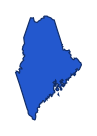
Name the state highlighted on map 09.
 THE HIGHLIGHTED STATE
Alaska and Hawaii appear in insets; all states use modern boundaries. Reveal answer
Maine. The highlighted state is Maine (ME). Maine projects into the far northeast, beyond New Hampshire. It is the easternmost New England state and has a long irregular Atlantic coastline.
Sources for this answer
Name the state highlighted on map 10.
 THE HIGHLIGHTED STATE

Alaska and Hawaii appear in insets; all states use modern boundaries. Reveal answer
Massachusetts. The highlighted state is Massachusetts (MA). Massachusetts lies south of Vermont and New Hampshire. Cape Cod curves outward from its southeastern coast, providing a useful recognition cue.
Sources for this answer
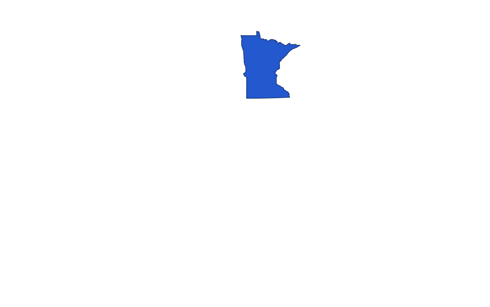
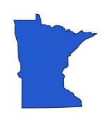
Name the state highlighted on map 11.
 THE HIGHLIGHTED STATE
Alaska and Hawaii appear in insets; all states use modern boundaries. Reveal answer
Minnesota. The highlighted state is Minnesota (MN). Minnesota lies north of Iowa and east of the Dakotas. Its northeastern tip reaches Lake Superior, while its northern edge meets Canada.
Sources for this answer
Name the state highlighted on map 12.
 THE HIGHLIGHTED STATE

Alaska and Hawaii appear in insets; all states use modern boundaries. Reveal answer
New Jersey. The highlighted state is New Jersey (NJ). New Jersey is east of Pennsylvania and south of New York. Its Atlantic coastline and narrow middle give it a different outline from Delaware to the southwest.
Sources for this answer
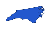
Name the state highlighted on map 13.
 THE HIGHLIGHTED STATE
Alaska and Hawaii appear in insets; all states use modern boundaries. Reveal answer
North Carolina. The highlighted state is North Carolina (NC). North Carolina stretches east to west below Virginia. Its western mountains contrast with the long Atlantic coast on its eastern side.
Sources for this answer
Name the state highlighted on map 14.
 THE HIGHLIGHTED STATE

Alaska and Hawaii appear in insets; all states use modern boundaries. Reveal answer
North Dakota. The highlighted state is North Dakota (ND). North Dakota lies below Canada and above South Dakota. Minnesota is to its east across much of the Red River boundary.
Sources for this answer
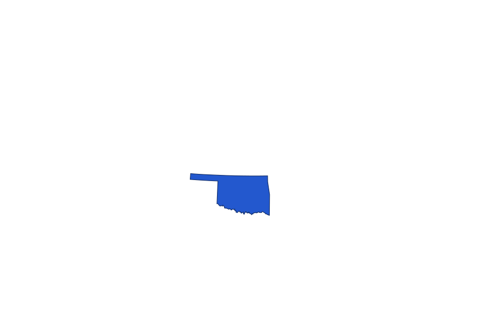
Name the state highlighted on map 15.
 THE HIGHLIGHTED STATE
Alaska and Hawaii appear in insets; all states use modern boundaries. Reveal answer
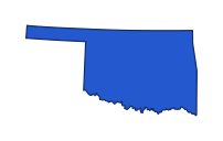
Oklahoma. The highlighted state is Oklahoma (OK). Oklahoma lies north of Texas, with a narrow panhandle stretching west. That panhandle is its clearest outline clue.
Sources for this answer
Name the state highlighted on map 16.
 THE HIGHLIGHTED STATE

Alaska and Hawaii appear in insets; all states use modern boundaries. Reveal answer
Pennsylvania. The highlighted state is Pennsylvania (PA). Pennsylvania lies below New York and west of New Jersey. A small northwestern projection reaches Lake Erie.
Sources for this answer
Name the state highlighted on map 17.
 THE HIGHLIGHTED STATE
Alaska and Hawaii appear in insets; all states use modern boundaries. Reveal answer
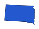
South Dakota. The highlighted state is South Dakota (SD). South Dakota is directly below North Dakota and above Nebraska. Wyoming is to its west, with Minnesota and Iowa to its east.
Sources for this answer
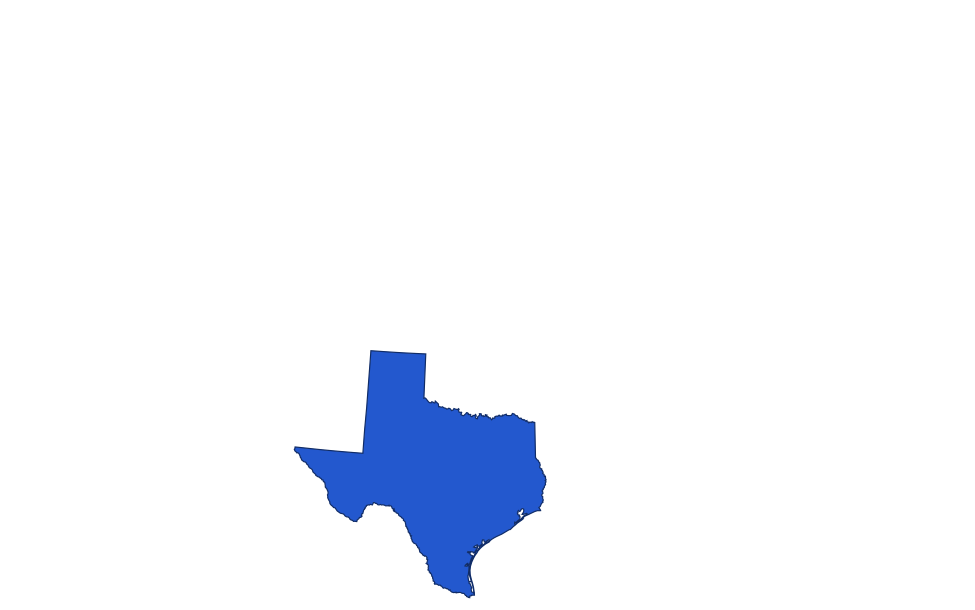
Name the state highlighted on map 18.
 THE HIGHLIGHTED STATE
Alaska and Hawaii appear in insets; all states use modern boundaries. Reveal answer
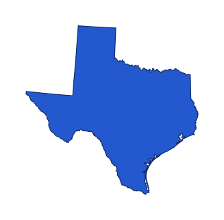
Texas. The highlighted state is Texas (TX). Texas lies south of Oklahoma and west of Louisiana. Its northern panhandle and long southern boundary help identify the large outline.
Sources for this answer
Name the state highlighted on map 19.
 THE HIGHLIGHTED STATE
Alaska and Hawaii appear in insets; all states use modern boundaries. Reveal answer
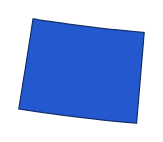
Wyoming. The highlighted state is Wyoming (WY). Wyoming is the rectangular state north of Colorado and south of Montana. Colorado’s similar outline lies directly below it.
Sources for this answer
Name the state highlighted on map 20.
 THE HIGHLIGHTED STATE

Alaska and Hawaii appear in insets; all states use modern boundaries. Reveal answer
Connecticut. The highlighted state is Connecticut (CT). Connecticut lies below Massachusetts, with New York to the west and Rhode Island to the east. Its southern edge faces Long Island Sound.
Sources for this answer
Name the state highlighted on map 21.
 THE HIGHLIGHTED STATE
Alaska and Hawaii appear in insets; all states use modern boundaries. Reveal answer
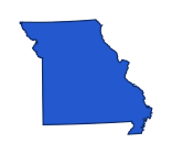
Missouri. The highlighted state is Missouri (MO). Missouri is below Iowa and above Arkansas. Its southeastern bootheel extends south along the Mississippi and helps distinguish its outline.
Sources for this answer
Name the state highlighted on map 22.
 THE HIGHLIGHTED STATE

Alaska and Hawaii appear in insets; all states use modern boundaries. Reveal answer
West Virginia. The highlighted state is West Virginia (WV). West Virginia lies west of Virginia and south of Pennsylvania. Its northern and eastern panhandles give it a particularly irregular outline.
Sources for this answer
Name the state highlighted on map 23.
 THE HIGHLIGHTED STATE

Alaska and Hawaii appear in insets; all states use modern boundaries. Reveal answer
Illinois. The highlighted state is Illinois (IL). Illinois lies west of Indiana and south of Wisconsin. Its northeastern corner reaches Lake Michigan, while its western boundary follows the Mississippi.
Sources for this answer
Name the state highlighted on map 24.
 THE HIGHLIGHTED STATE
Alaska and Hawaii appear in insets; all states use modern boundaries. Reveal answer
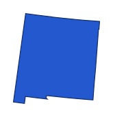
New Mexico. The highlighted state is New Mexico (NM). New Mexico lies between Arizona and Texas, below Colorado. A short extension at its southwestern corner interrupts its otherwise block-like outline.
Sources for this answer
Name the state highlighted on map 25.
 THE HIGHLIGHTED STATE

Alaska and Hawaii appear in insets; all states use modern boundaries. Reveal answer
Arkansas. The highlighted state is Arkansas (AR). Arkansas sits south of Missouri and north of Louisiana. The Mississippi River gives much of its eastern edge an irregular outline.
Sources for this answer
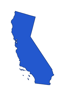
Name the state highlighted on map 26.
 THE HIGHLIGHTED STATE
Alaska and Hawaii appear in insets; all states use modern boundaries. Reveal answer
California. The highlighted state is California (CA). California occupies much of the Pacific coast below Oregon. Its long coastline and angled eastern boundary distinguish it from Nevada, immediately inland.
Sources for this answer
Name the state highlighted on map 27.
 THE HIGHLIGHTED STATE

Alaska and Hawaii appear in insets; all states use modern boundaries. Reveal answer
Delaware. The highlighted state is Delaware (DE). Delaware is the small state east of Maryland and south of Pennsylvania. Its curved northern boundary helps distinguish it from the longer New Jersey across the Delaware River.
Sources for this answer
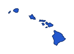
Name the state highlighted on map 28.
 THE HIGHLIGHTED STATE
Alaska and Hawaii appear in insets; all states use modern boundaries. Reveal answer
Hawaii. The highlighted state is Hawaii (HI). Hawaii is an island chain in the central Pacific. The inset groups its islands for readability and does not show its real distance from the mainland.
Sources for this answer
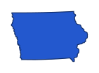
Name the state highlighted on map 29.
 THE HIGHLIGHTED STATE
Alaska and Hawaii appear in insets; all states use modern boundaries. Reveal answer
Iowa. The highlighted state is Iowa (IA). Iowa lies between the Missouri River on much of its west and the Mississippi on its east. Minnesota is directly north and Missouri directly south.
Sources for this answer
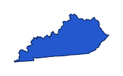
Name the state highlighted on map 30.
 THE HIGHLIGHTED STATE
Alaska and Hawaii appear in insets; all states use modern boundaries. Reveal answer
Kentucky. The highlighted state is Kentucky (KY). Kentucky stretches east to west below Ohio and Indiana and above Tennessee. Its northern boundary largely follows the Ohio River.
Sources for this answer
Name the state highlighted on map 31.
 THE HIGHLIGHTED STATE

Alaska and Hawaii appear in insets; all states use modern boundaries. Reveal answer
Maryland. The highlighted state is Maryland (MD). Maryland wraps around the northern Chesapeake Bay and narrows sharply in the west. Delaware lies to its east and Pennsylvania to its north.
Sources for this answer
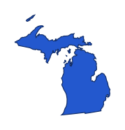
Name the state highlighted on map 32.
 THE HIGHLIGHTED STATE
Alaska and Hawaii appear in insets; all states use modern boundaries. Reveal answer
Michigan. The highlighted state is Michigan (MI). Michigan has two major peninsulas. The Lower Peninsula lies between Lakes Michigan and Huron, while the Upper Peninsula stretches along Lake Superior.
Sources for this answer
Name the state highlighted on map 33.
 THE HIGHLIGHTED STATE

Alaska and Hawaii appear in insets; all states use modern boundaries. Reveal answer
Mississippi. The highlighted state is Mississippi (MS). Mississippi lies between Louisiana and Alabama, below Tennessee. Its western border largely follows the river that shares its name.
Sources for this answer
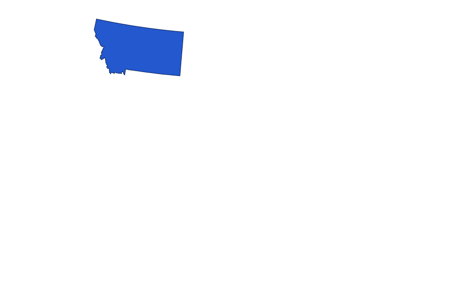
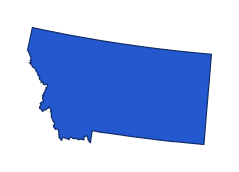
Name the state highlighted on map 34.
 THE HIGHLIGHTED STATE
Alaska and Hawaii appear in insets; all states use modern boundaries. Reveal answer
Montana. The highlighted state is Montana (MT). Montana is the broad state just below Canada, east of Idaho and north of Wyoming. Its western edge is much more irregular than its eastern side.
Sources for this answer
Name the state highlighted on map 35.
 THE HIGHLIGHTED STATE

Alaska and Hawaii appear in insets; all states use modern boundaries. Reveal answer
New Hampshire. The highlighted state is New Hampshire (NH). New Hampshire lies between Vermont and Maine, north of Massachusetts. It widens toward the south and has a short Atlantic coast.
Sources for this answer
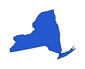
Name the state highlighted on map 36.
 THE HIGHLIGHTED STATE
Alaska and Hawaii appear in insets; all states use modern boundaries. Reveal answer
New York. The highlighted state is New York (NY). New York reaches from the Great Lakes toward the Atlantic. Long Island extends east from its southeastern corner, and New England lies to its east.
Sources for this answer
Name the state highlighted on map 37.
 THE HIGHLIGHTED STATE

Alaska and Hawaii appear in insets; all states use modern boundaries. Reveal answer
Ohio. The highlighted state is Ohio (OH). Ohio lies east of Indiana and west of Pennsylvania. Lake Erie forms its northern edge, while the Ohio River curves along its south.
Sources for this answer
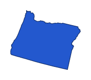
Name the state highlighted on map 38.
 THE HIGHLIGHTED STATE
Alaska and Hawaii appear in insets; all states use modern boundaries. Reveal answer
Oregon. The highlighted state is Oregon (OR). Oregon is on the Pacific coast between Washington and California. Its northern boundary follows much of the Columbia River.
Sources for this answer
Name the state highlighted on map 39.
 THE HIGHLIGHTED STATE

Alaska and Hawaii appear in insets; all states use modern boundaries. Reveal answer
Tennessee. The highlighted state is Tennessee (TN). Tennessee is a long, narrow state below Kentucky and above Alabama and Mississippi. It stretches from the Mississippi River toward the Appalachians.
Sources for this answer
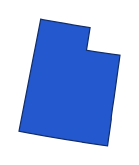
Name the state highlighted on map 40.
 THE HIGHLIGHTED STATE
Alaska and Hawaii appear in insets; all states use modern boundaries. Reveal answer
Utah. The highlighted state is Utah (UT). Utah lies west of Colorado and north of Arizona. Its northeastern corner is cut away where Wyoming extends south.
Sources for this answer
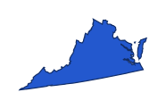
Name the state highlighted on map 41.
 THE HIGHLIGHTED STATE
Alaska and Hawaii appear in insets; all states use modern boundaries. Reveal answer
Virginia. The highlighted state is Virginia (VA). Virginia stretches from the Appalachians to the Atlantic, south of Maryland and West Virginia. Its eastern portion surrounds the southern Chesapeake Bay.
Sources for this answer
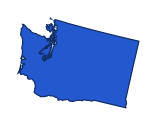
Name the state highlighted on map 42.
 THE HIGHLIGHTED STATE
Alaska and Hawaii appear in insets; all states use modern boundaries. Reveal answer
Washington. The highlighted state is Washington (WA). Washington occupies the Pacific Northwest above Oregon. Its western coastline includes the deep indentation of Puget Sound.
Sources for this answer
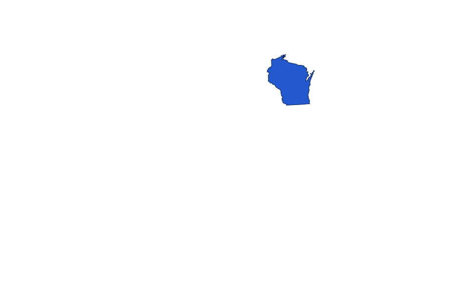
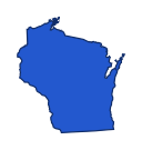
Name the state highlighted on map 43.
 THE HIGHLIGHTED STATE
Alaska and Hawaii appear in insets; all states use modern boundaries. Reveal answer
Wisconsin. The highlighted state is Wisconsin (WI). Wisconsin lies west of Lake Michigan and north of Illinois. Lake Superior also reaches its northern edge.
Sources for this answer
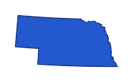
Name the state highlighted on map 44.
 THE HIGHLIGHTED STATE
Alaska and Hawaii appear in insets; all states use modern boundaries. Reveal answer
Nebraska. The highlighted state is Nebraska (NE). Nebraska lies north of Kansas and south of South Dakota. Its western panhandle reaches farther west than the central portion of its southern boundary.
Sources for this answer
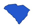
Name the state highlighted on map 45.
 THE HIGHLIGHTED STATE
Alaska and Hawaii appear in insets; all states use modern boundaries. Reveal answer
South Carolina. The highlighted state is South Carolina (SC). South Carolina lies below North Carolina and east of Georgia. Its roughly triangular outline widens along the Atlantic coast.
Sources for this answer
Name the state highlighted on map 46.
 THE HIGHLIGHTED STATE
Alaska and Hawaii appear in insets; all states use modern boundaries. Reveal answer
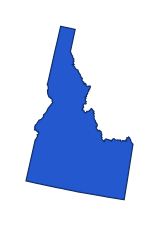
Idaho. The highlighted state is Idaho (ID). Idaho has a narrow northern panhandle above a wider southern section. Montana lies to its east and Oregon and Washington to its west.
Sources for this answer
Name the state highlighted on map 47.
 THE HIGHLIGHTED STATE
Alaska and Hawaii appear in insets; all states use modern boundaries. Reveal answer
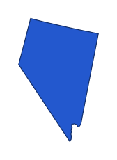
Nevada. The highlighted state is Nevada (NV). Nevada lies east of California and west of Utah. Its long sloping southwestern edge follows California’s angled boundary.
Sources for this answer
Name the state highlighted on map 48.
 THE HIGHLIGHTED STATE

Alaska and Hawaii appear in insets; all states use modern boundaries. Reveal answer
Vermont. The highlighted state is Vermont (VT). Vermont lies west of New Hampshire and east of New York, below Canada. It is wider in the north than in the south.
Sources for this answer
Name the state highlighted on map 49.
 THE HIGHLIGHTED STATE
Alaska and Hawaii appear in insets; all states use modern boundaries. Reveal answer
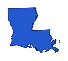
Louisiana. The highlighted state is Louisiana (LA). Louisiana sits south of Arkansas and west of Mississippi. Its irregular coastline and lower Mississippi delta distinguish it from neighboring inland states.
Sources for this answer
Name the state highlighted on map 50.
 THE HIGHLIGHTED STATE

Alaska and Hawaii appear in insets; all states use modern boundaries. Reveal answer
Rhode Island. The highlighted state is Rhode Island (RI). Rhode Island lies east of Connecticut and south of Massachusetts. It is small enough that the enlarged outline is especially helpful.
Sources for this answer
Answer key
- Alabama. The highlighted state is Alabama (AL). Alabama lies between Mississippi and Georgia, below Tennessee. Its short southern coastline helps distinguish it from neighboring inland Tennessee.
- Alaska. The highlighted state is Alaska (AK). Alaska is northwest of Canada, separate from the contiguous states. Its long southeast panhandle and island chain are distinctive even when it appears in a map inset.
- Arizona. The highlighted state is Arizona (AZ). Arizona lies below Utah and west of New Mexico. Its mostly straight outline bends along the Colorado River boundary on the west.
- Colorado. The highlighted state is Colorado (CO). Colorado is the nearly rectangular state directly north of New Mexico. Wyoming has a similar shape but lies farther north.
- Florida. The highlighted state is Florida (FL). Florida’s long peninsula points south, while its panhandle extends west below Alabama. This combination is more distinctive than either part alone.
- Georgia. The highlighted state is Georgia (GA). Georgia is directly north of Florida, between Alabama and the Atlantic coast. Its eastern neighbor along much of that side is South Carolina.
- Indiana. The highlighted state is Indiana (IN). Indiana lies between Illinois and Ohio, with Michigan to the north. Its small Lake Michigan frontage is at the northwestern corner.
- Kansas. The highlighted state is Kansas (KS). Kansas lies directly below Nebraska and above Oklahoma. Its northeast corner is less regular than the rest of its mostly rectangular outline.
- Maine. The highlighted state is Maine (ME). Maine projects into the far northeast, beyond New Hampshire. It is the easternmost New England state and has a long irregular Atlantic coastline.
- Massachusetts. The highlighted state is Massachusetts (MA). Massachusetts lies south of Vermont and New Hampshire. Cape Cod curves outward from its southeastern coast, providing a useful recognition cue.
- Minnesota. The highlighted state is Minnesota (MN). Minnesota lies north of Iowa and east of the Dakotas. Its northeastern tip reaches Lake Superior, while its northern edge meets Canada.
- New Jersey. The highlighted state is New Jersey (NJ). New Jersey is east of Pennsylvania and south of New York. Its Atlantic coastline and narrow middle give it a different outline from Delaware to the southwest.
- North Carolina. The highlighted state is North Carolina (NC). North Carolina stretches east to west below Virginia. Its western mountains contrast with the long Atlantic coast on its eastern side.
- North Dakota. The highlighted state is North Dakota (ND). North Dakota lies below Canada and above South Dakota. Minnesota is to its east across much of the Red River boundary.
- Oklahoma. The highlighted state is Oklahoma (OK). Oklahoma lies north of Texas, with a narrow panhandle stretching west. That panhandle is its clearest outline clue.
- Pennsylvania. The highlighted state is Pennsylvania (PA). Pennsylvania lies below New York and west of New Jersey. A small northwestern projection reaches Lake Erie.
- South Dakota. The highlighted state is South Dakota (SD). South Dakota is directly below North Dakota and above Nebraska. Wyoming is to its west, with Minnesota and Iowa to its east.
- Texas. The highlighted state is Texas (TX). Texas lies south of Oklahoma and west of Louisiana. Its northern panhandle and long southern boundary help identify the large outline.
- Wyoming. The highlighted state is Wyoming (WY). Wyoming is the rectangular state north of Colorado and south of Montana. Colorado’s similar outline lies directly below it.
- Connecticut. The highlighted state is Connecticut (CT). Connecticut lies below Massachusetts, with New York to the west and Rhode Island to the east. Its southern edge faces Long Island Sound.
- Missouri. The highlighted state is Missouri (MO). Missouri is below Iowa and above Arkansas. Its southeastern bootheel extends south along the Mississippi and helps distinguish its outline.
- West Virginia. The highlighted state is West Virginia (WV). West Virginia lies west of Virginia and south of Pennsylvania. Its northern and eastern panhandles give it a particularly irregular outline.
- Illinois. The highlighted state is Illinois (IL). Illinois lies west of Indiana and south of Wisconsin. Its northeastern corner reaches Lake Michigan, while its western boundary follows the Mississippi.
- New Mexico. The highlighted state is New Mexico (NM). New Mexico lies between Arizona and Texas, below Colorado. A short extension at its southwestern corner interrupts its otherwise block-like outline.
- Arkansas. The highlighted state is Arkansas (AR). Arkansas sits south of Missouri and north of Louisiana. The Mississippi River gives much of its eastern edge an irregular outline.
- California. The highlighted state is California (CA). California occupies much of the Pacific coast below Oregon. Its long coastline and angled eastern boundary distinguish it from Nevada, immediately inland.
- Delaware. The highlighted state is Delaware (DE). Delaware is the small state east of Maryland and south of Pennsylvania. Its curved northern boundary helps distinguish it from the longer New Jersey across the Delaware River.
- Hawaii. The highlighted state is Hawaii (HI). Hawaii is an island chain in the central Pacific. The inset groups its islands for readability and does not show its real distance from the mainland.
- Iowa. The highlighted state is Iowa (IA). Iowa lies between the Missouri River on much of its west and the Mississippi on its east. Minnesota is directly north and Missouri directly south.
- Kentucky. The highlighted state is Kentucky (KY). Kentucky stretches east to west below Ohio and Indiana and above Tennessee. Its northern boundary largely follows the Ohio River.
- Maryland. The highlighted state is Maryland (MD). Maryland wraps around the northern Chesapeake Bay and narrows sharply in the west. Delaware lies to its east and Pennsylvania to its north.
- Michigan. The highlighted state is Michigan (MI). Michigan has two major peninsulas. The Lower Peninsula lies between Lakes Michigan and Huron, while the Upper Peninsula stretches along Lake Superior.
- Mississippi. The highlighted state is Mississippi (MS). Mississippi lies between Louisiana and Alabama, below Tennessee. Its western border largely follows the river that shares its name.
- Montana. The highlighted state is Montana (MT). Montana is the broad state just below Canada, east of Idaho and north of Wyoming. Its western edge is much more irregular than its eastern side.
- New Hampshire. The highlighted state is New Hampshire (NH). New Hampshire lies between Vermont and Maine, north of Massachusetts. It widens toward the south and has a short Atlantic coast.
- New York. The highlighted state is New York (NY). New York reaches from the Great Lakes toward the Atlantic. Long Island extends east from its southeastern corner, and New England lies to its east.
- Ohio. The highlighted state is Ohio (OH). Ohio lies east of Indiana and west of Pennsylvania. Lake Erie forms its northern edge, while the Ohio River curves along its south.
- Oregon. The highlighted state is Oregon (OR). Oregon is on the Pacific coast between Washington and California. Its northern boundary follows much of the Columbia River.
- Tennessee. The highlighted state is Tennessee (TN). Tennessee is a long, narrow state below Kentucky and above Alabama and Mississippi. It stretches from the Mississippi River toward the Appalachians.
- Utah. The highlighted state is Utah (UT). Utah lies west of Colorado and north of Arizona. Its northeastern corner is cut away where Wyoming extends south.
- Virginia. The highlighted state is Virginia (VA). Virginia stretches from the Appalachians to the Atlantic, south of Maryland and West Virginia. Its eastern portion surrounds the southern Chesapeake Bay.
- Washington. The highlighted state is Washington (WA). Washington occupies the Pacific Northwest above Oregon. Its western coastline includes the deep indentation of Puget Sound.
- Wisconsin. The highlighted state is Wisconsin (WI). Wisconsin lies west of Lake Michigan and north of Illinois. Lake Superior also reaches its northern edge.
- Nebraska. The highlighted state is Nebraska (NE). Nebraska lies north of Kansas and south of South Dakota. Its western panhandle reaches farther west than the central portion of its southern boundary.
- South Carolina. The highlighted state is South Carolina (SC). South Carolina lies below North Carolina and east of Georgia. Its roughly triangular outline widens along the Atlantic coast.
- Idaho. The highlighted state is Idaho (ID). Idaho has a narrow northern panhandle above a wider southern section. Montana lies to its east and Oregon and Washington to its west.
- Nevada. The highlighted state is Nevada (NV). Nevada lies east of California and west of Utah. Its long sloping southwestern edge follows California’s angled boundary.
- Vermont. The highlighted state is Vermont (VT). Vermont lies west of New Hampshire and east of New York, below Canada. It is wider in the north than in the south.
- Louisiana. The highlighted state is Louisiana (LA). Louisiana sits south of Arkansas and west of Mississippi. Its irregular coastline and lower Mississippi delta distinguish it from neighboring inland states.
- Rhode Island. The highlighted state is Rhode Island (RI). Rhode Island lies east of Connecticut and south of Massachusetts. It is small enough that the enlarged outline is especially helpful.